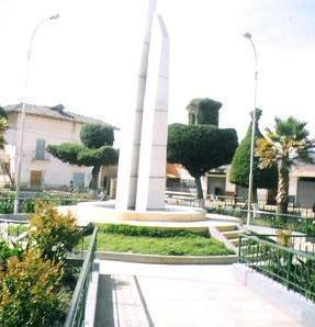
Hucaybamba City


Huacaybamba, Huánuco, Peru
Suggest Place to Visit
504
Track to location with GPS |
 |
PREINCA TIME
The ancient spaces of the province of Marañón (today Huacaybamba) were visited by renowned scholars and researchers of the country, among them: Antonio Raimondi, Julio C. Tello, Francisco Rubén Berroa, Santiago Antúnez de Mayolo, Bertrán Flornoy, Donato Híjar Soto, among others. At present, no in-depth studies have been carried out, nor have any state or private institution expressed their concern regarding the gradual process of destruction and state of neglect in which all the remains of Huacaybamba are found. These same concerns were revealed by the archaeologist Rógger Ravines after his arrival with Dr. Donald Thompson at the Tinyash citadel, after having carried out important archaeological investigations in the area.
Although the exact time in which the man arrived in Peru is unknown, it is estimated that it was about 20 thousand years ago, this due to the remains that have been found in the province of Lauricocha; in the same way, some authors point out that the first men entered through the northern part of our territory, while others maintain that it was the entry through the jungle, which is not possible to affirm. Proof of its presence in the soil of Huacaybamba are the rock pictographs left in the areas of Diablo Gagamarca, Quillcay and Diablo Rumi (right bank of the Pinra River, studied by Víctor Falcón Huayta in 1996), where zoomorphic figures predominate and on a smaller scale the anthropomorphic ones. The animals they represent are the auquénidos and the cervids, and it is likely that they are linked to the existing fauna, as a wealth and basic element to satisfy their needs.
The Early Intermediate is represented by quadrangular buildings built with large stone blocks, with access openings that lead to interior galleries; its ceilings made with large stone slabs placed in a staggered way, forming a false vault ceiling. In the Late Intermediate period, at the beginning of the 11th century, this region was inhabited by warlike tribes, such as the Antas, Paucaricras, Callanas and Orejones, who made up the Huacrachucos nation.
From the studies of Dr. Federico Kauffmann Doig made in 1981 - 1985 on the Huacrachucos he explains “This group appears located on the right bank of the Marañón, between the territory of the Chachapoyas and that of the Huanucos and to the west of the Conchucos. According to the current political division, the Huacrachucos lived in what are now the provinces of Marañón and Huacaybamba. The Amazonian Andes rise to the east of its territory. In the territory of the Huacrachucos there are various archaeological testimonies, such as those around the current Huacrachuco and Huacaybamba. The most unique and impressive are the Tinyash and those of Pumpu in Peru and perhaps in the world the monumental vestiges at the highest altitude: 4160 m.a.s.l. Located on the heights of Pinra, in its vicinity is Huarigancha or Huaricancha, a sanctuary dedicated to the god Huari of which only traces remain ”.
Dr. José Varallanos (1959: 72) mentions “The nation of the Huacrachucos or the Andes of the Marañón occupied lands on the eastern side of the Marañón River, from Singa to the North, up to the current province of Huamachuco. On a steep topography, it was a numerous and warlike tribe that wore as a distinctive a cap that ended in a deer horn. Hence its name wuacra-chucos, which, in Quechua, means: hat or cap in the shape of a horn. They were governed by curacas called campis, who were the ones who dealt with the Victorious Incas, as Garcilaso affirms; calling themselves ovas to the common people. They worshiped snakes, the condor, the forces of nature; and they worshiped their ancestors… They built their rooms in safe places and carved stone monoliths, to which, like their divinities, they erected small and mysterious temples ”.
INCA PERIOD
In the 15th century, Túpac Inca Yupanqui continuing the expansive work of his father Pachacútec; He dedicated himself to expanding his territorial possessions and at the same time maintaining order, peace, improvement of the social and economic organization and the administration of the Inca State. In their advance towards the north they managed to conquer the Huacrachucos, who tenaciously resisted the imperial army, when they managed to be subdued these peoples cried in what is now Huacaybamba.
Garcilaso de la Vega (1973: 78) writes “It was necessary for the Inca to first conquer that Huacrachucu province to pass to the Chachapuya; and thus commanded to straighten his army to her. The natives took up defense, daring in the rough fight of their land and even confident of victory, because it seemed impregnable to them. With this confidence they went out to defend the passes, where there were great reunions and many deaths on both sides.
Currently there is the royal road of the Incas, in some places in the provinces of Huacaybamba and Marañón, in a state of destruction, in parts used by bridle paths and others in abandonment. For example, the road that starts from the remains of Tinyash travels along the Punas de Pinra and continues north on the shores of the Huascacocha, Mancacocha, Torococha and other lagoons. Likewise, the Inca Bridge stands out, a magnificent work built based on carved stones through which the waters of the Rambrash River flow, in Cochabamba.
COLONIAL PERIOD
In the times of the Spanish colony, Mr. López García de Castro in 1565, established the "townships of natives" to replace the criminal encomiendas. In 1575, King Felipe II ordered that the divisions of Indians and their towns be placed under the jurisdiction and government of corregidores. In the official report of Viceroy Martín Enríquez de Almansa of 1583, the town of “San Pedro de Guacaybamba” appears, which together with San Antonio de Mancha (Corregimiento de Huamalíes) formed the Distribution of Mancha, entrusted to Don Juan Manuel de Saavedra.
In 1586, in the domain of Viceroy Fernando de Torres y Portugal, Archbishop Toribio de Mogrovejo visited the Doctrine of Mancha and Guacaybamba, finding the Parish of San Pedro de Huacaybamba in operation with its annexes: Yumba, Acobamba, Lurigancha, Santiago de Asa , San Francisco de Rondobamba and San Cristóbal de Colca. In 1,741, Huacaybamba occupied the seventh place among the parishes of the Huamalíes Party, with two annexes: Rondobamba and Huarigancha.
REPUBLICAN AGE
Huacaybamba as a member of the Huamalíes Party has had the following political changes: By Law of November 4, 1823, the Constituent Congress designates to unite the departments of Tarma and Huaylas in a single department; in the union of 8 provinces was Huamalíes, to whose jurisdiction Huacaybamba belonged. By Decree of the Governing Council of September 13, 1825, the department of Huánuco changes its name in honor of the Battle of Junín.
The word ‘Huacaybamba’ according to the historian José Varallanos (1959: 47) “It is translated by: valley of tears; de wagar = cry and de bamba = valley or plain; it can also mean: plain of the shrine; from huaca or waka = shrine, and bamba = pampa or plain ”. The first version is based on the catastrophe of "AYARAGRA" (Quebrada de Muertos) as a result of the malarial disease that devastated the valleys of the coast and the mountains, whose dead scattered in houses and huts gave the name of Ayaragra, the few Survivors migrated to the high parts of a frigid climate, occupying the slopes and plains, in one of which the town is currently located, and they cried inconsolably their misfortune, turning this plain into Huagay-pampa that gave rise to Huacaybamba slightly modified in its phonetics . What remains to be described is the date of the catastrophe, not being able to specify from when it took the name of Huacaybamba or Huagaypampa, this place, having an approximate of the year 1778.
It is located in the north-western part of the Huánuco region, on the right bank of the Marañón River; between 08 ° 44'55 "- 09 ° 08'55" of South Latitude, and 76 ° 05'55 "- 77 ° 01'00" of West Longitude of the Meridian of Greenwich. Its provincial UBIGEO code is No. 1004.
SURFACE
It has a territorial extension of 1,743.70 Km2 (183,356.92 hectares) that represents 4.73% of the total area of the Huánuco region. Politically it is divided into 4 districts, 9 populated centers and 49 hamlets.
CAPITAL
Its capital is the Villa de Huacaybamba, it is located in the last foothills of the Central Mountain Range and on the second terrace of the Tocana, Condormarca and Cashamarca hills, at an altitude of 3,168 meters above sea level.
Huacaybamba
It has the following tourist attractions
TINYASH
WAKE OF TNYASH
MANCHAG
CHONTA
MAGASH RAY
RAY MAGAS FALL
DIABLO RUMI
CHURCH ALTABLES
Comments
We don´t have yet any comments about:
Hucaybamba City
Hucaybamba City
Be the first to leave a comment as it is very important to inform other people
Outros locais a visitar
Within a radius of 20 km from:Hucaybamba City
Unfortunately we do not have information on other places to visit in this area yet
Hotel reservation near Hucaybamba City within a radius of 20 km
No results
Why to book with RUTAS TURISTICAS
The best prices
Our partnerships with the world´s largest operators offer research on the best market prices.
More options
At Rotas Turisticos you can book the hotel, buy the air ticket, book the transfer from the airport to the hotel and vice versa, book the local excursions, rent the car, take travel insurance and consult the places to visit and where to go.
Holiday Tips & Destinations
Hundreds of holiday destinations with all the options that allow you to easily choose the destination that best suits your dream vacation.
RUTAS TURISTICAS
Links
Follow us on social networks


